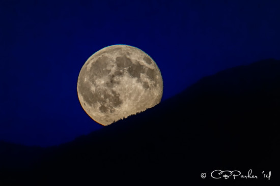
Supermoon from Boat Bay anchorage on July 12, 2014
The title says a great deal about navigating in this part of the world. Mike and I have been exploring a section of the Inside Passage which extends more than 1,000 miles from Washington’s Puget Sound all the way to Skagway in Southeast Alaska. But we confined our explorations to the southern portion along the eastern shore of Vancouver Island, up to but no farther than the Broughton Archipelago, a stretch of some 350 miles not taking into account detours and driving in circles watching for whales!
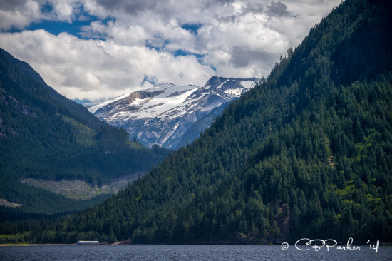
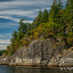
Agamemnon Strait en route to Princess Louisa Inlet
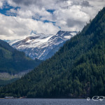
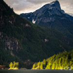
There are thousands of islands in this area tangled in a labyrinth of waterways. The major inlets wind their way between evergreen cloaked hills to the feet of snow capped mountains and glaciers, including 13,186 foot Mt. Waddington. As the tides rise and fall, the water floods and ebbs through the passes, channels and straits. At the peak of high and low tides, both of which occur twice a day, water races through some of these constrictions at a velocity in knots that can reach double digits creating rapids, whirlpools and overfalls – all conditions to be avoided in a yacht, especially when complicated by the presence of hazardous rocks!
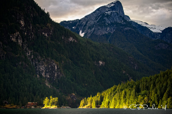
Malibu Rapids, entrance to Princess Louisa Inlet, at sunrise
As a result we are armed with multiple cruising guides and Canadian Hydrographic Service charts & sailing directions to help calculate best strategy and timing to get from here to there. The best practice is to navigate the rapids at or near slack tide when the water flow is at its calmest. At each critical bottleneck a parade of boats converge to await optimum transit time. Our very first experience was the Malibu Rapids entrance to Princess Louisa Inlet – a short skinny blind S-turn only wide enough for one boat at a time with rocky shoals to port and starboard . The recommended strategy here is to broadcast via VHF radio channel 16 a “securité, securité, securité” announcement of your intent to enter or exit the channel, giving oncoming boats time to make their presence known.
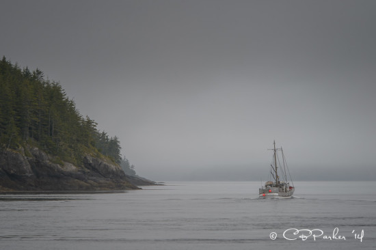
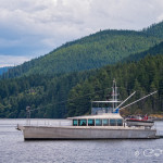
Fishing trawler in the fog, Blackfish Sound
Wind force and direction need to be taken into consideration as well – strong winds opposing the direction of the current rapidly create a whitewater cauldron of steep choppy waves that can create havoc with small boats. We did learn over time that the winds are generally quiet in the morning, build to a crescendo in the afternoon, and die away again come evening (we also learned that the weather service apparently overstates the wind conditions). When it is too fierce to travel, there are many pleasant protected anchorages for waiting out the weather. However often we found that on the light wind days, foggy conditions and drizzle plagued us instead.
As newbies to the area, and without the security blanket of our experienced Captain Rod on board, we took every guidebook warning and weather forecast devoutly to heart. For the first few weeks of our cruise the weather service constantly broadcast gale force wind warnings of 25-40 knots in the Johnstone Strait, a critical waterway for traveling either north or south. The windy conditions were accompanied by the buildup to July 12th’s supermoon, which exaggerated the tides to an even greater extent than a plain old regular moon. But as we followed instructions to the letter (and let other yachts precede us), each transit gave us more confidence to negotiate the next. By yesterday, the end of our explorations for the time being, we had built up nerve to tackle the Seymour Narrows.
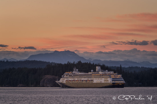
At sunset a cruise ship sails north in the Discovery Passage towards the Seymour Narrows
Just north of our layover marina in Campbell River is the most notorious section of the Inside Passage. Cruise ships making the run between Alaska and Seattle time their entire itinerary around the optimum time (which changes every day) to navigate the Narrows. At maximum flood the flow can reach 16 knots (AVATAR’s normal cruising speed is 9-10 knots). Prior to 1958 a large submerged rock, Ripple Rock, generated hazardous turbulence and whirlpool activity to such an extent that twenty or more large vessels were sunk over the years and more than 100 lives lost. In 1958, after several years of preparation (and the loss of more lives in the process), Ripple Rock was dynamited into oblivion in the largest non-nuclear explosion in history up to that time.
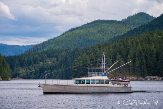
Iron Lady in Kanish Bay
Our transit was perfectly timed and non-eventful, although the turbulence argued with the autopilot, pushing AVATAR’s bow left and right as we went through. We followed a tug towing a barge stacked high with shipping containers at a respectful distance, and right behind us was AVATAR’s sister ship Iron Lady, hull #3 of the FPB 64s, who is also exploring this part of the world. We caught up with Iron Lady for the first time yesterday in Kanish Bay where we both lingered, photographing each other, until time to head into the Narrows. Iron Lady has been cruising the South Pacific since launch, and arrived in British Columbia mid-May by way of Hawaii.
Two identical distinctive vessels in the same neighborhood have caused quite a bit of commentary. At each marina and anchorage, AVATAR is mistaken for Iron Lady who has preceded us. Our unusual yachts have garnered more than the average amount of attention here in Canada, possibly because boaters here recognize a serious boat when they see one. Curious sightseers check us out each time we tie up at a new marina – at Port McNeill the sailboat berthed just in front of us commented that our arrival had really increased the foot traffic on our shared section of dock.
We’ve had a great adventure, with more to share about wildlife and wilderness cruising, but that will be the subject of the next blog. AVATAR is now secure in a marina and Mike and I are headed back to the states in a few days, flying from Campbell River to Seattle by float plane, and then on to New York City for my photography exhibition and artists’ reception July 31 plus a few weeks of catch-up at home before we return for phase two of our Pacific Northwest adventures.
The gallery below contains the blog photos and some additions, playable as a slideshow.
-

- Supermoon from Boat Bay anchorage, July 12, 2014
-
- View from Agamemnon Strait
-
- View from Queens Reach near Malibu Rapids
-
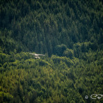
- Float plane over Gorge Harbour
-
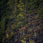
- Shores of Agamemnon Strait
-
- Malibu Rapids from Queens Reach at sunrise
-
- Exit from Gorge Harbour
-
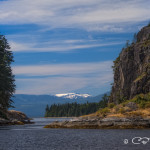
- Entrance to Gorge Harbour
-
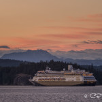
- Cruise ship at sunset headed north from Campbell River towards the Seymour Narrows
-
- Narrow channel entrance to Octopus Islands from Hole in the Wall
-
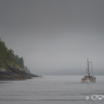
- Fishing boat in the fog, Blackfish Sound
-
- Iron Lady in Kanish Bay
Thank you for sharing your adventures. While your blog provides a small window into your adventures, your pictures expand them into another horizon. Your ability to capture the essence of a moment is extraordinary.
Robert
Looks like an amazing trip! Then to see Iron Lady also! Beautiful! See you in New York!
Hi Robert, Thanks for the kind words. I enjoy documenting our travels and looking back on our adventures.