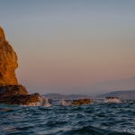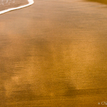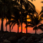
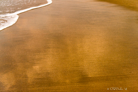
I made a quick visit to AVATAR in Ixtapa, Mexico, right after Thanksgiving and enjoyed a tropical escape that included walking the long golden beaches of this upscale resort town and exploring small outlying islets by boat, dinghy and kayak.
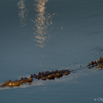
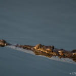
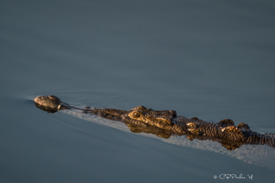
Although the two side by side cities of Ixtapa and Zihuatanejo are located in the restive state of Guerrero, they are free of the violence plaguing other parts of the state including Acapulco. I felt more unease in regards to the ‘No Swimming’ signs posted in the marina complete with illustrations of the resident crocodiles that glide among the boats!
The islets are a quick cruise away and make a great day trip destination. The water is warm and offers swimming, snorkeling, kayaking and other water sports, and the sand beaches are lined their entire length with mariscos – palapa shaded seafood cantinas – squeezed in shoulder to shoulder. Each restaurant is differentiated from its neighbor primarily by the color of the tablecloths adorning the molded plastic tables wedged into the sand. The proprietors compete to flag down prospective diners, each extolling the virtues of his own establishment. They even motor out in open boats into the anchorage to hand out business cards, solicit customers, and offer free transportation to the beach!
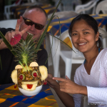
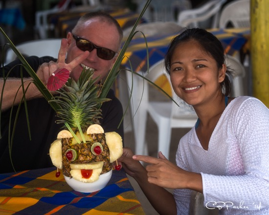
There is no electricity on the islands and ice is expensive (we were informed), so all the seafood is fresh caught. We ordered our main course from a selection presented on a tray that ranged from lobster to red snapper, and the shrimp I chose were the best I have ever eaten. May’s piña colada arrived in an entire pineapple. A couple of pet bunnies begged at our feet for scraps of salad, and a passing parade of vendors stopped at our table to offer wares ranging from wood carvings, jewelry, snack foods and clothing, to a serenade on a homemade musical instrument that appeared to have been constructed from discarded tin cans!
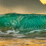
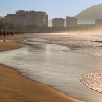
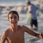
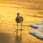
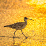
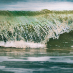
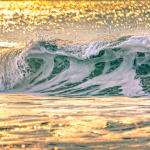
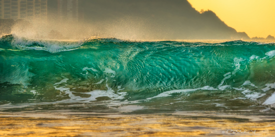
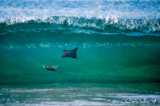
 For me the photographic highlight of my visit was the beach walk in Ixtapa, only a short distance from our marina berth, where friendly vacationing Mexicans exercise along the long curving sand beach and small pygmy devil rays surf in the breaking waves!
Now it is early January and we have embarked on the third leg of our journey to our destination of Florida, with each leg representing roughly 1,500 miles in a 6,000 mile itinerary from west coast to east. We’re another year older but last year’s plan, for now, is unchanged. Leg 1 was Seattle to San Diego this past September following our summer explorations in British Columbia. Leg 2 saw Rod and May moving AVATAR south from San Diego to Ixtapa/Zihuatanejo on Mexico’s southern coast, where they paused for the holidays from Thanksgiving through New Year’s Day. Currently we are moving southeasterly to transit the Panama Canal for Leg 3. The fourth and final leg will be from Panama to Florida by way of Jamaica with a planned arrival window in March.
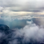
School geography and gut instinct intuit that we are traveling south down the coast of Mexico, but we are really headed more easterly than anything else. As I write, we are currently 28 hours into a 36 overnighter from Ixtapa to Huatulco. The sun is rising directly off the bow and if I dropped a plumb line due south on a map from the U.S. to our current position, we would be directly below Houston, Texas. Southern Mexico and the narrow neck of land that contains all the Central American countries along our route really angles more along a west to east line than north to south.
This past Tuesday I returned to Zihuatanejo – an easy flight nonstop aboard Alaska Airlines out of LA. Rod, May and I celebrated our upcoming voyage at El Galeón, one of several upscale restaurants that line the Ixtapa Marina waterfront. Wanting to reach Huatulco by daylight, a 360 mile journey, we pulled out from our marina berth at 2 a.m. Wednesday morning.
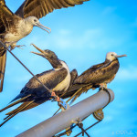
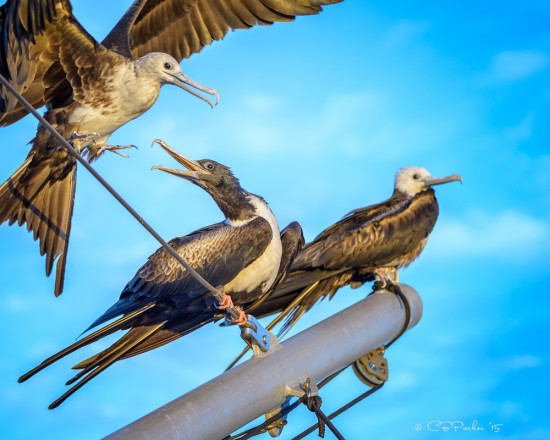
The alarm for my first turn at watch rang just before 6 a.m. Wednesday morning, fortuitously timed to enjoy sunrise over the sea, with coastal mountains paralleling our route portside and to starboard 2,500 miles of open sea before encountering French Polynesia (tempting!). Still dark, I heard chirping noises and went out on deck to investigate. A pair of frigatebirds were maneuvering for a landing on one of AVATAR’s booms. I hurried for my camera and gambled on several low light shots with high ISO and slow shutter speeds, presuming they would soon be on their way. Three hours later I was leisurely composing my shots in bright daylight as our hitchhikers continued their assisted migration! They did eventually fly off, but when I commenced my midnight watch 18 hours later, I was greeted by four new frigates spaced along our portside boom, claws curled around a guy wire, facing forward with feathers ruffled by the headwind, gently bobbing to AVATAR’s motion through the swells.
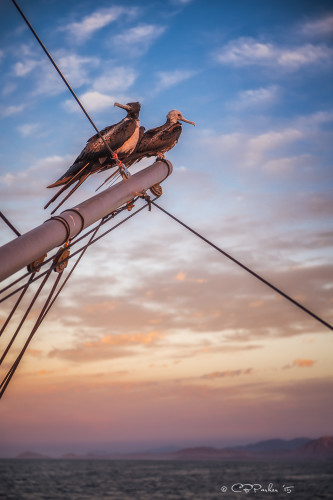
Frigatebirds are large seagoing birds with a wingspan that can reach 7 feet and a bent wing profile in flight reminiscent of a pterodactyl. Flocks of them glide lazily high in the sky in search of prey. Instead of catching their own fish, they hover overhead in wait, letting other species of seabirds do the work. When a successful gull or booby passes below with a catch, the frigates dive bomb the unfortunate bird and engage in aerial skirmishing until the harassed victim loses its grip and the frigates are able to steal its fish. The facts that they are poor swimmers and their feathers lack waterproofing are key to their piratical behavior! In addition to their propensity for petty thievery, they are also apparently out for a free ride when it comes to conveniently passing boats. This does not sit well with Rod, who is in charge of cleaning the dinghy that is stationed right below their impromptu perch.
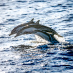
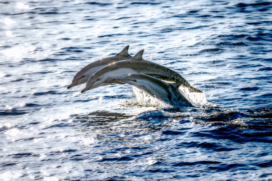
En route we’ve also had several encounters with pods of dolphins, and I learned tonight on my midnight watch that yes, they do surf the bow wave of passing boats at night as well as by day!
The weather is calm and pleasant, hot in mid day running in the 80s-90s which I find much more appealing than the cold snap we were suffering at home which included snowfall in Tucson on New Year’s Eve.

But the sea is lumpy with swells on a short fetch, causing AVATAR to bob uncomfortably in a corkscrew motion. ‘One hand for the boat’ is a yachtsman’s mantra, doubly applicable now since a lurch could cause a misstep resulting in a tumble down the steep stairs from the flying bridge to the hard aluminum deck. Even brushing my teeth is a balancing act! We’re not sure why the sea is so uncomfortable at the moment, but possibly it is because we are approaching the Gulf of Tehuantepec, although it is still 100+ miles away from our current position.
 The Gulf of Tehuantepec has a reputation for fierce gales and steep, dangerous seas. It is located on the western coast of Mexico’s narrowest point, the Isthmus of Tehuantepec only 200 kilometers wide, which connects the Caribbean side to the Pacific. The topography causes the wind to funnel and build in strength as it blows from east to west over the land bridge, creating the severe conditions in the Gulf. Rod was inclined to discount the dire warnings as exaggeration until he started studying the raw weather data in the grib files and discovered that, day after day, the wind has been blowing in the 50-60 knot range! Giving due respect, our game plan includes a layover of unknown length in the resort town of Huatulco, the last Mexican departure port before crossing over to Guatemala, while we monitor the weather in the Gulf looking for a forecast of calm conditions. We only need a 24 hour window of travel time to sail across in a direct line. The alternatives are to either sail offshore some 500 miles and go around, or hug the unhuggable rugged, rock studded coastline. The current arctic weather sweeping across the U.S. directly affects the force of the gale winds across the Gulf, so we are anticipating a leisurely visit to Huatulco and surrounding environs before things quiet down.
Photography aboard a boat underway makes me chuckle when I read the textbook techniques for landscape photography – tripods, careful composition, optimal shutter speed and aperture for lens effects, use of a remote control or time delay to trigger the shutter while avoiding camera shake. Aboard AVATAR my technique for shooting a sunrise (for example) is to wedge my body for balance against something solid like a table or bench or lifeline, bend my knees for (hopefully) shock absorption, jam my elbows into my ribs and the camera viewfinder into my eye socket for stabilization, use a high shutter speed to compensate for the motion of the boat and my precarious balancing act, and fire a burst of multiple shots in hopes that one of them will have a horizon line that is level! Photographing cavorting dolphins adds the extra level of complexity of not knowing when or where the next one will erupt from the sea. The result is a large photographic collection of splashes, occasionally containing miscellaneous body parts, predominately tails!
Cheers to all. I will check in again from Huatulco where, hopefully, we will have internet suitable for uploading photos (PS – we have arrived and Huatulco has awesome internet which has enabled this post and guarantees a follow-up!).
Click on any photo below to open a full screen slideshow of the above images and more.