To position AVATAR for our ICW adventure, first we had to relocate from South Pacific waters to the continental United States. After accomplishing that in late 2013, it took another two seasons to transit from west coast to east, due in part to our unplanned delay in Mexico last year.
But now we’re really on our way! By mid-March AVATAR had completed the final leg of a 5,500 mile journey from Seattle to Ft. Lauderdale, via San Diego, south along the Pacific coasts of Mexico and Central American countries, through the Panama Canal, a brief stop in Jamaica, and along the narrow shipping lane between the islands of Haiti and Cuba (both countries off limits to American yachts), and north through the chain of islands that is the Bahamas, finally arriving in Florida on schedule.
Offshore AVATAR is a pretty quick boat, averaging 10 knots, so that in 24 hours she can cover 240 miles and a 1,000 mile passage can be completed in just four or five days. The ICW measures 1,000 miles long from Ft. Lauderdale to the south end of the Chesapeake Bay in Virginia but, as we set forth, reality is setting in. Negotiating the ICW compares to bluewater cruising like hiking a switchback mountain trail compares to driving down the Interstate!
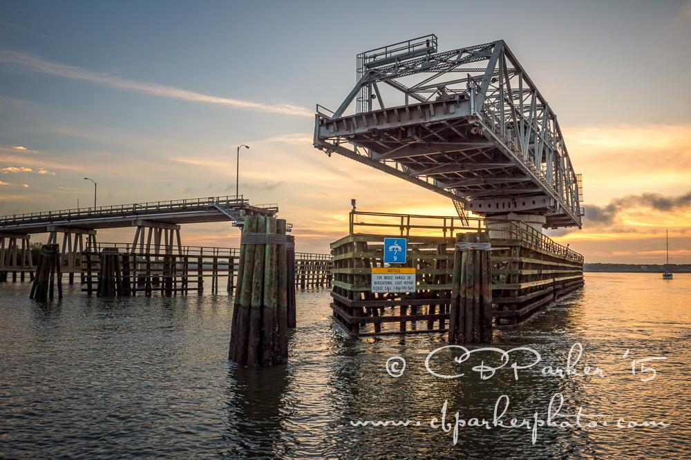
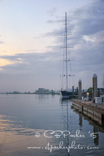
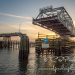
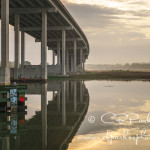
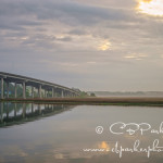
First there are the bridges. Our count is 88 bridges en route. On Day One we encountered 18 bridges! Day Two, 13 more bridges! AVATAR has an ‘air draft’ of 26 feet. Our cruising guides list all the bridges that span the ICW with their individual clearances (which vary by tide) and schedules. With bridge heights of more than 27′ we sail under with confidence, but lower bridges must be opened to let us pass through. Markers on the bridge supports display measurements for real time clearance based on the water level. This bridge offered 65 feet, no problem for AVATAR.
Some lift up to open, others swivel laterally.
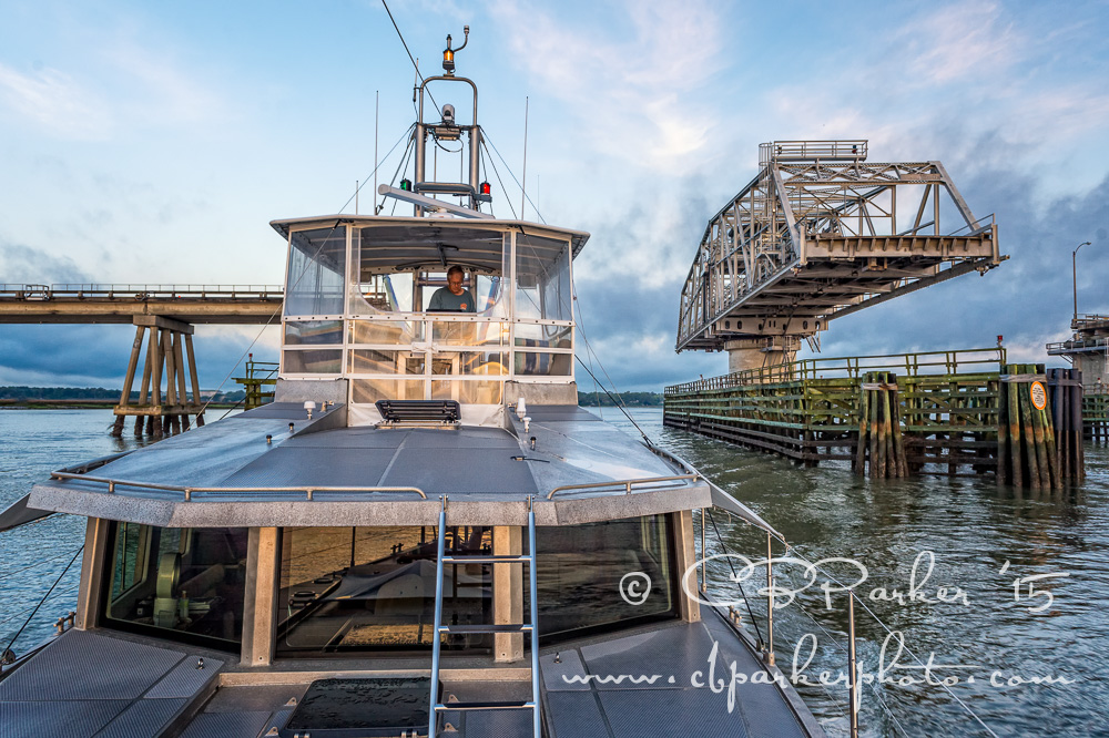
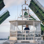
Some open on demand, others are on a schedule. To request an opening we make VHF radio contact with the bridge operator who then stops car traffic and raises the bridge for us. In areas with more congested traffic the openings take place each to its own timetable, perhaps every 30 minutes or so, but it varies. Trying to ‘make the bridges’ is like trying to negotiate timed red traffic lights. When you miss one, you will find yourself sailing in circles for half an hour or more waiting for the next opportunity to pass under. Of course the sailboats run a much bigger obstacle course than we do with their tall masts.
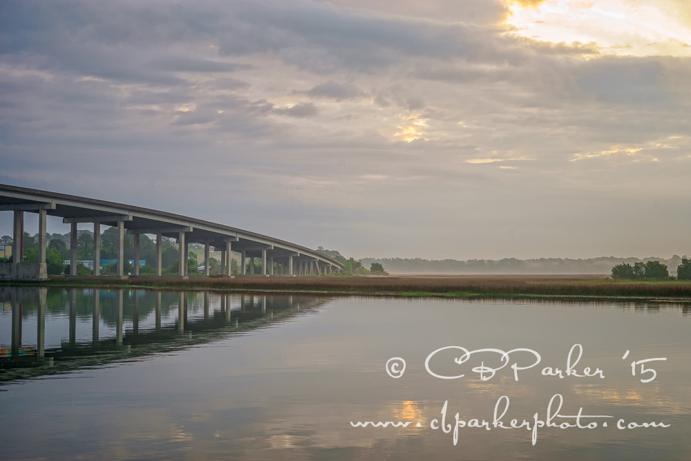
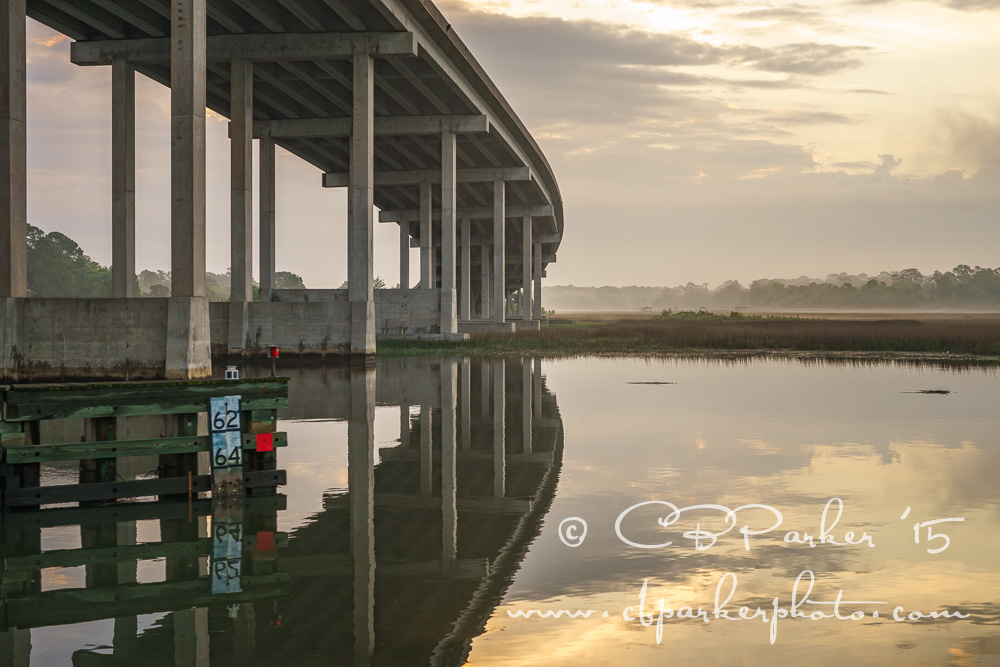
The next challenge is depth. Parts of the ICW consist of deep water rivers, but further south, particularly in Georgia, shallow depths and constantly shifting shoals require a dredging program to maintain a navigable depth. Funding for the dredging is in short supply, so the charted depths can’t be taken for gospel truth. Our bibles, the cruising guides, spell out the trouble spots mile marker by mile marker. AVATAR draws 5 1/2 feet in depth; we keep one eye on the charts and the other eye on the depth sounder as it reads off the numbers. Thus far we have survived some of the more notorious stretches with names such as ‘Hell Gate’ and ‘Little Mud River’.
We signed up for towing insurance, just in case. Boats often have tongue-in-cheek names and I saw one recently named Runaground Sue. The strategy to safeguard against running aground is to pass through the unavoidable shallow spots on a rising tide. That way, if we do get stuck, the plan is to wait it out and, hopefully, float off as the water rises. Tides around here vary by 8-9 feet from low to high, so timing makes a significant difference. Since the bottom is soft sand and mud, no real damage should occur. Steve Dashew, AVATAR’s designer, quips that it’s a good way to clean marine growth off the boat bottom without getting wet!
Both scenarios contribute to slow progress northwards. It would be foolhardy to travel by night in the dark. Based on tide tables and upcoming shallow stretches, sometimes we can’t even start on the next day’s run until mid-day. In Georgia a low-tide low-bridge combo with bad timing actually set us back a couple of days! Even the moon figures in to the calculations; during phases of a new or full moon, so-called spring tide highs and lows are exaggerated beyond the numbers listed on our charts.
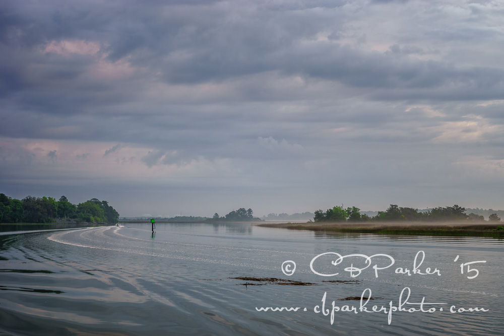
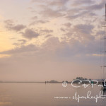
A further complication, the ICW is a narrow winding channel that snakes its way through a Medusa’s head of creeks, rivers, sounds and bays that mark the lowlands of North Florida, Georgia, and the Carolinas. We are guided by a series of hundreds of numbered red and green channel markers, red to port and green to starboard, that steer us along the serpentine path of the navigable portions of the waterway. Stray outside the markers at your peril!
The net result is that we’re averaging 30 miles per day instead of 240, and the Chesapeake is looking quite far away! Admittedly, as ICW novices, we’re taking the cowardly approach; the good news is that there’s more time for sight seeing!

The AVATAR Logs: 88 Bridges 8×8
Photographer Carol Brooks Parker and her husband have been cruising aboard their boat part time for more than ten years, covering a range to date of 36,000 miles and 18 countries. She writes about their cruising adventures and occasional side trips in her blog, The AVATAR Logs, giving each post the…

SLIDESHOW – Click any thumbnail below to open:


Thank you for a beautiful blog! Just curious: SetSail mentions a draft of 4.5 feet rather than 5.5? Also, is your defying autopilot still the original W-H one?
SetSail does say 4 1/2 feet draft at half load. We’re erring on the side of caution, taking into account that the boat with two heavy dinghies aboard, personal possessions, and perhaps more than a half load of fuel and water, may be sitting deeper in the water than specs. Also I’ve been told that when sailing in such shallow water, the boat ‘squats’ and the stern drops down lower than would be normal. Our swim step is actually awash here in the ICW, which is not normally the case. Those extra inches add up. Captain Rod told us to figure we could clear 1.7 meters which is 5.58 feet, so we’ve been taking that to heart.
If we’ve really got an extra foot, all to the better!
We still have the original WH Autopilot system but have replaced assorted parts along the way.
What an interesting commentary about the ICW. It’s so different than your other photos. Way cool!
The scenery is quite different from what we’re used to as well!